Wednesday, March 4, 2015

Rånkeipen and some unsolicited advice on ski crampons

I've had a little unplanned hiatus from the blogosphere on account of being busy with other stuff and not having much to report on. We're entering the prime season here in Norway though so I think its about time I pulled my finger out and started posting again.

Today invovled a sterling outing on Rånkeipen with Markus, Magnus and Axxa. I'll let the pictures speak for themselves. Suffice to say it was very fun.
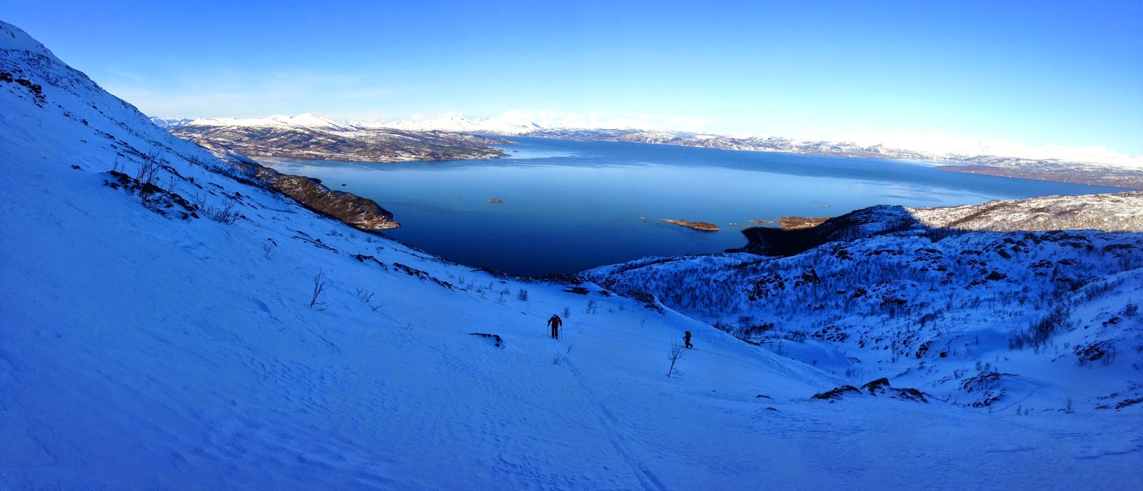
Once we cleared the dense birch trees the views over Ofotfjorden were totally OK

Axxa has a red speed suit. She is also one of the most enthusiastic and speediest touring partners I've ever had.


Looking South

Looking North

Magnus and Axxa approaching the summit of Rånkeipen

Axxa covered about 2x the vert that the rest of us did.

As usual the summit pitch was rimed up and kind of wind jacked. And as usual the views were pretty decent.

The skiing was mostly dust on crust. But this is better than simply crust

Magnus and Axxa on the cruisy lower section

Markus and Ofotfjorden

Markus and Rånkeipen


And now for some unsolicted advice on ski crampons
One of the fantastic things about all the wind jacked snow in northern Norway is the great value for money we get for our ski crampons. Despite how regularly I feel like I use them I am constantly surprised by the number of people who don’t own a pair or don’t know how to fit them to their skis effectively. So I decided to share a little unsolicited instructional rant.

First off, get some. If you ever bring an ice axe and crampons on your outings in the alpine, then you will also benefit from having some ski crampons.

I have seen some weird techniques for fitting/removing ski crampons. Some people even go so far as to remove their boot from the binding to fit the ski-crampon, this is unnecessary and just as ridiculous as taking your ski off to rip your skins.

Like any decision in ski mountaineering, the choice to fit or remove your ski crampons is all about anticipation. Look ahead, think about the snow surface and slope angle. It’ll be much easier to fit on a small ledge in softer snow than on some steep boiler plate.

If I’m expecting to use ski crampons I have them hanging on a small toy carabiner from my pack somewhere easily accessible, not inside my pack. They make a nice jangling noise like chimes and mean you can put them on in a jiffy without having to take your pack off.

Step 1) Unclip your ski crampons one at a time.

Step 2) If you are fitting the ski crampon to your left ski, hold the ski crampon in your right hand and 
plant your left pole solidly in the snow/ice to help balance.

Step 3) Stand on your right ski and lift your left ski up, swing it around behind your right leg.

Step 4) Bend over and slot the ski crampon into position.

Step 5) Repeat the process for the other ski.

Below is a little demonstrational  video


Ski Crampons- how to put them on better from Kaj Sønnichsen on Vimeo.

Thursday, November 13, 2014

Running in Australia

Just finished up a two weeks visit back in Australia, aside from catching up with family and drinking a lot of coffee and beer, I was keen to get some training done. In particular I was eager to log some vertical in preparation for the upcoming winter of touring and also to revisit some of the mountains in the SE corner of Australia which were such an integral part of my upbringing.

Over the years I’ve found that most people (Australians included) are oblivious to the mountains of Australia, thinking that beyond the picturesque beaches lies a flat and arid interior. Whilst it is true that the climate in Australia is arid, the idea that it is all flat isn’t quite accurate. The area in the SE of Australia, including the Snowy Mountains (something of a misnomer) and the Victorian Alps comprise dozens of peaks with a respectable relief from the nearby valleys. True, mountain terrain is mostly quite gentle and benign with rounded “hills” rather than jagged spired dominating the skyline; and true, the snowline is usually quite high, but if you are keen there is some great trail running and some interesting ski touring to be had.

I enjoyed four standout trail runs while I was in the country:

Mt Bogong, up and down the Staircase (about 16km and 1450+ metres, 2:20)

The highest point in Victoria, and one of the first mountains I hiked up as a kid. I have many memories of this peak, such as sleeping on the summit without any water as a teenager on a summer hike over from Hotham, and on another occasion teaching myself how to self-arrest with an exceptionally long, old axe borrowed from a friend.

The run was nice, however I discovered that I’ve spent enough time out of Australia in the past years to have grown unaccustomed to reptiles and had a few frights encountering half a dozen blue tongued lizards which I instinctually thought to be snakes.


Mt Buffalo, up the Big Walk (about 11km and 1050+ metres, 1:30)

This was the first place I ever went skiing at the age of 5. Good to see it again.
Earlier this year this place hosted Australia's first ever event in the SkyRunning series.


Mt Feathertop, up the Bungalow Spur and along the Razorback Ridge (about 22km and 1700+ metres, 2:55)

The nicest mountain trail in Australia in my opinion; a perfect balance between being runnable and also steep sections which require more effort. Not much in the way of views whilst I was there though:


Mt Kozciusko and the Main Range Track from Thredbo (about 44km and 1800+ metres, 5:02)


I used to think that the Main Range track was the best trail in the Australian Alps, and it certainly does have some terrific views over the highest peaks in Australia. The trail has received an immense amount of upkeep in the past decade, to the point where a quad bike could now comfortably traverse most of the track. After a winter with heavy snowfall there was still quite a bit of it around for early November, I even saw one fellow skiing on Carruthers Peak


Thursday, September 18, 2014

Running Waikaremoana

I was meaning on getting over to Te Urewera to run around the famed Lake Waikaremoana last winter but with the logistical hassle of the car shuttle my focus always shifted to other trails closer by which were simpler to access. With Thor visiting and stormy weather forecast for the central plateau, I figured it was high time to finally check it out.

A 6:30am departure from Natty P saw us get to Murupara before 9am where our hopes of buying some electrolyte mix from the supermarket (quite ridiculous in hindsight) morphed into settling for a few packets of tropicana RARO. We hit the road again and with only 100km left to drive figured that we would be running by around 11am, however the winding, gravel road soon slowed us down and we kept recalculating our start time. By the time we stashed a few bags with clothes and some food at a lodge at the end and drove back to the northern start, it was past 1pm and it was obvious that we'd be finishing in the dark.


Lake Waikaremoana track, stolen from here
Undeterred we set out from the Hopuruahine end hoping to make up some time on the early section of the track which sounded relatively flat and simple. The trails was indeed pretty flat but this was balanced out by how muddy it was from some heavy rainfall a few days earlier. Before long our shoes and legs were caked in a thick layer of mud.


It started out muddy...

But got drier as we got deeper into the forest.


After the initial flat kms trail was gently undulating and for the most part gentle enough to run.

All the streams and rivers have cool suspension bridges, which are much harder to run on than they look.
The miles rolled by with sweet singletrack, constantly undulating through dense podocarp forest. Every so often the track would be near enough to the lake edge to offer up some terrific views over the lake, but for the most part it felt like we were running in the middle of some ancient forest in the middle of nowhere.


Did I mention it was muddy?
After 5 hours on the move we reached the Panekire hut at dusk, and with only 8.5 km of downhill left were pretty much on pace to be finished in a little over 6 hours. However with the darkness came the rain and mist, and our descent down the technical and rooty trail slowed to walking pace. Even with decent headlamps we struggled to see more than a few metres through the dense fog and sideways rain, we forgot all about our hopes of coming in under a certain time and focussed instead on not falling and twisting an ankle on the rugged trail.

We got a few glimpses of the lake from the Panekire bluff just before the sun set and the rain settled in.


Wet and cold, but stoked after 50km of stellar trails
In the end we ended up reaching the end of the trail exactly 7:00 after setting out. Soaked to the bone and a little cold we were then rewarded with a bonus 4 km to get back to the self contained unit we'd rented for the night, at 8:50pm we finally got our shoes off and warmed up with some hot soup and cold beer.

The Panekire bluff seen from the road, on the drive home the next day.
It is an amazing trail and one which ought to get run a lot more often. For next time there are a few things I'd change:
  1. By travelling in the opposite direction you'd get the major climb done on fresh legs, and would have a much more runnable descent.
  2. Start earlier in the day.
  3. Do it at least a few days since the most recent rain, to ensure a little less mud.

Thursday, September 11, 2014

Ngauruhoe and Taranaki revisited

Brother Thor is visiting at the moment and I wanted to show him a few of the gems of skiing on the North Island: Ngauruhoe and the 'Naki. With two days off from work and a decent high pressure system everything lined up perfectly. Ling joined us too.

Day 1: 
Ngauruhoe north slopes via the  usual walk in the Mangatepopo valley and up to South Crater. Nice corn snow.


After a sweet but relatively short ski descent (snow line is around 1600metres at the moment), we got in the car and drove over to Taranaki via the Forgotten World Highway. The 4 hour drive over on the windy road featured hitting a possum and a hare in the car, a flat tyre on one of the unsealed sections of the road and one of the dirtiest burgers I've ever had the pleasure of eating from a chinese takeaway store in Stratford. We camped out for the night in a carpark just below the North Egmont visitor centre.

Day 2:
The day started with a breakfast of espresso and a few gingernuts. Then we set out walking up to the Tahurangi lodge and were soon in the clouds with visibility down to about 30 metres, we decided to continue up in the hope that we would climb above the clouds.


Sure enough, at about 2000 metres we were clear of the whiteout and enjoyed some terrific views over a sea of clouds.


The skiing was undoubtedly the best I've had this season in NZ, perfect corn and a steady slope angle of 35°. Good times indeed. The spring skiing season is officially opened.

Monday, September 1, 2014

Running the Tongariro Northern Circuit

Just before the weekend I had another run on the Tongariro Northern Circuit. It's one of the most popular multi-day walking tracks in NZ, seeing several thousand trampers every summer who sleep in large huts spaced 10-15kms apart along the trail. In winter the trail doesn't see quite so many folk, but it is still quite runnable for the most part, even if a good portion of the track is above snowline and steep around the Red Crater area. It is 43.1 km long and involves roughly 1700 metres of elevation gain. Last year I made it around in 5:34 and was stoked to shave 20 minutes off that on this outing. Photos are quite dodgy on account of my phone having a smudged lens or something.


Flowy, well groomed trail at the outset from the Village up to Tama lakes. Then rougher and rockier but still entirely runnable over to Waihohonu hut.


From here the trail traverses through some native forest before entering the desert on the eastern side of the peak and through old lava flows up to the Oturere hut. The prettiest part of the trail in my opinion, not that these fuzzy photos would suggest so.


  Above snowline (around 1500m at the moment) soft conditions made for slower travel. Up to Emerald lake I was thankful that the snow was soft enough to kick steps. From the highpoint down to south crater conditions were much firmer and required some poise in the running shoes.


On the descent into Mangetepopo valley there was some quality, smooth trail until the junction the trail heading back over the the Village which is quite rutted and heavily eroded.


Setting out from the Whakapapa Village these were my splits
0:36 Tama lakes junction
1:27 Waihohonu Hut
2:28 Oturere Hut
3:13 Emerald Lake
4:11 Mangatepopo junction
5:13 Whakapapa Village

On the menu: 3x clif shots and 2 litres of clif electrolyte drink