Wednesday, October 30, 2013

Skiing Tapuae-o-Uenuku

Tapuae-O-Uenuku (or Tappy) in the Kaikoura Range of the northern part of the South Island is the highest mountain in New Zealand outside of the Mt Cook region. It's where Ed Hillary cut his teeth on climbing and carrying heavy packs whilst walking in rivers and through thick vegetation. Steeped in history and with a location which means it breaks up the drive when headed south to other mountains, Tappy is actually a very worthy destination mountain in itself, with a memorable approach, cool terrain and a very isolated atmosphere when on the upper parts of the mountain.

Skiing Tappy is all about the approach, the ski to hike ratio is so lob-sided that only the ignorant or foolish would even contemplate it. After a 50km drive up the Awatere Valley I parked on the side of the road and given the late hour, bivvied by the car ‘til first light. The route up to the mountain follows the Hodder River for 22kms and 1000 vertical metres of hiking along the river bank on polished river stones and repeatedly wading through the fast flowing river which ranged in depth from knee to crotch. I soon lost count of the number of times that I crossed the river, but going off other trip reports I’ve read, 80 crossings each way sounds like the average. To make things more interesting a few landslides in the past few weeks had created small dams in the river which were extra deep.

The Hodder River- one river crossing down, 79 to go!

After about 40 crossings the doubt was starting to creep in... 
 The river itself alternated between broad, braided sections and steep gorges which required walking directly up the river itself. Travel was slow and I’d be lying if I said I wasn’t beginning to doubt whether all the effort would be worth it.  So after 6 hours of walking in wet shoes it was a relief to reach the Hodder Huts at 1500 metres. I spent the rest of the day uneventfully reading and listening to music.

Finally at the comfortable huts, my home for the night
     
Beautiful sea of clouds at 7am looking down the upper Hodder drainage
At 6.30 the next morning I was back in my still wet running shoes and moving again. After one final river crossing the uphill in loose scree began in earnest. By 7.30 I’d reached the snowline just below 2000 metres and quickly changed to ski boots and crampons. From here it was all smooth sailing. A good re-freeze overnight made for a fast and easy ascent up the final 900 metres.

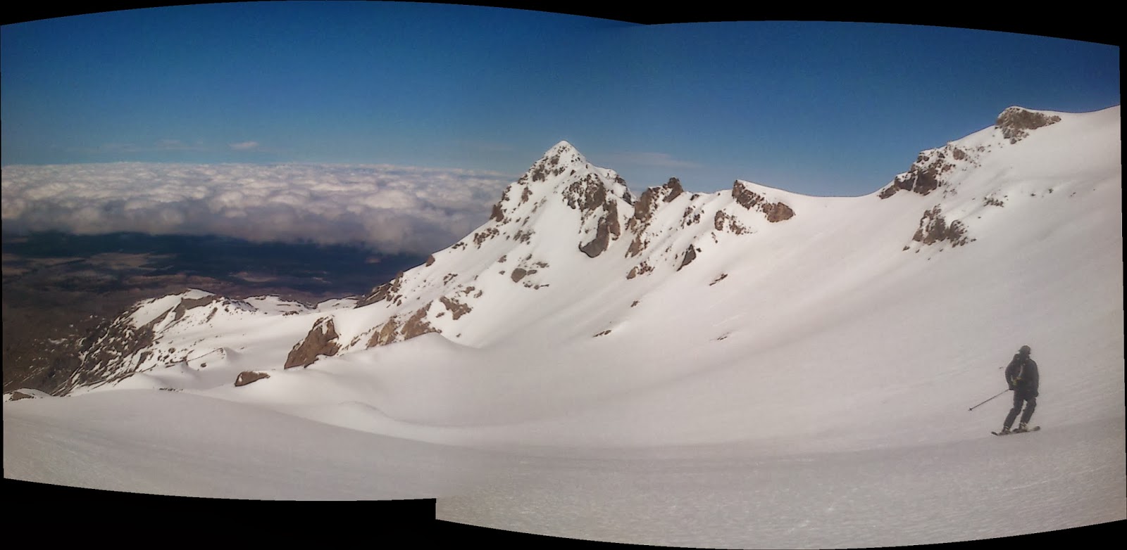
Mt. Alarm and Mitre Peak- great ski terrain if you can be bothered to carry your gear in.

view from the summit
Another view from the summit. That's the South Pacific lurking below the clouds

The snow was firm, but edge-able.

Selfie at the start of the out hike
 I was a little too early to get the snow in its perfect corn state, and impatient to wait around for it to soften up. So I skied the firm slopes back down the way I’d come, and changed back in to running shoes for the long walk back to the car. There is loads of potential for steep skiing in this area. If I was to come back, it with be with more food so that you could be based at the huts for a few days and explore all of the opportunities on offer.

Friday, October 11, 2013

Welcome to Gnarvik

With the ski season winding up here in New Zealand and reports of snowfall on the peaks in northern Scandinavia, my stoke for getting back to Narvik for the winter was already sky high. Add to this Norrøna's short film released today to promote their new line of baggy jackets for ski fashionistas and I'm left champing at the bit.

It was filmed over a few days last April in the area immediately surrounding Narvik, and showcases the many reasons I choose to live in Northern Norway. Enjoy it.

 
Welcome to narvik from Norrona on Vimeo.

Sunday, October 6, 2013

Ruapehu Grand Slam

After a week of good melt-freezes the corn skiing season is in its prime here on Mt. Ruapehu. A lap on the Mangatoetoenui Glacier yesterday afternoon convinced me that now was the time to link together all six glaciers on the mountain into one fantastic, circular traverse.

We started the day with a chairlift ride over the barren lower slopes, and then a shot of espresso and a slathering of sunscreen at the ski patrol HQ. At 9 we started skinning on firm snow up the slopes to the saddle between Tukino Peak and Glacier Knob. A quick skate across the summit plateau brought us to the top of the Mangatoetoenui Gl. and its easterly aspect was already slightly softened by the morning sun and offered up some brilliant first turns for the day.

Mike hiking the last section to the saddle.

turns down the upper Mangatoetoenui

From here a short skin back up to Cathedral Rock was followed by descent of the Whangaehu Gl. on firm snow before wrapping around a ridge into the Crater Lake drainage. As we skinned up the drainage a barrage of rocks from the rapidly warming northern slopes of Mitre Peak reminded us that spring was well and truly upon us. Our route up the large basin was well protected though and had a perfect firm surface for crampons.

Mike skiing below Cathedral Rocks
Skinning up the Crater Lk. drainage
And booting up towards Mitre Peak.
A short walk up the ridgeline towards Tahurangi and we were ready for skiing the stunning Wahianoa Gl. which combined ripe corn with expansive views over Girdlestone and the remote SE corner of the mountain.

Mike starting down the Wahianoa Glacier with Girdlestone in the centre of the picture
After a bite to eat we booted up to the broad col which separates Girdlestone from Tahurangi and stood above the Mangaehuehu glacier, our fourth for the day. Firm rime on this shadier aspect made for the worst skiing on the traverse, so rather than descend down the fall line we opted to traverse above the Turoa ski resort towards the Mangaturuturu glacier. The skiing here was more sun softened corn and we enjoyed a great line down to the lower cliff bands before our final skin back up to the Pare Col.

Mike above the Mangaehuehu glacier with Girdlestone peak in the background

Skiing the Mangaturuturu glacier
Skirting around the Crater Lake we looked over at the points we had passed a few hours earlier, amazed with ourselves for not having completed this terrific ski tour earlier in the winter. The last run down the Whakapapa glacier and back to the ski area was also on fantastic snow. Our total trip time 4:32, left me thinking that we ought to have milked a few more turns on the Wahianoa and made the day a longer one.

Another view of Crater Lake

Mike on the last descent of the day back down to Whakapapa.

This traverse confirmed my long held suspicions that ski touring on Ruapehu is all about the spring corn: just when the crowds are thinning out, the skiing is at its absolute best. Looking forward to the final few weeks on the mountain and some more great spring skiing!

Thursday, September 19, 2013

Skiing Taranaki

Wednesday had a good weather forecast and with a whole day off from work I decided to check out Taranaki, one of NZ's most famous volcanoes.

To get there I had to drive through the Shire (locally known as the Forgotten World Highway) with its ridiculously picturesque hills and meadows so green that I suspect someone might have actually painted the grass. At one stage I even had to stop the car to let a duck lead its family of waddling ducklings across the road. It was all so bucolic and quaint that I started feeling queasy (although that might have been the combination of grapefruit juice, peppermint slice and snus with which I stuffed myself whilst driving).


After 4 hours of driving from National Park I parked the car at the North Egmont visitor center and started up the well maintained service track at the crack of 11 o'clock. The track climbs steadily through native bush and scrub for about 600 vertical metres to the Tahurangi hut.


After a lazy transition from running shoes into ski boots and crampons I started marching up the lower gullies, soft snow on sunny aspects gave an early indication that the skiing was in. I passed a few other folks on the way up, some on foot and a couple skinning. Going off beta that skins usually weren't very useful owing to the steep incline and typically rimed slopes, I'd left my skins in the car, but they definitely would have made for a faster ascent in the soft conditions that I encountered.

Not really knowing much about the standard route on the mountain, I chose a more direct line up one of the major ramps on the east face (I learned later that this is know as the Surrey Rd route), this proved to be straight forward, mostly about 35° with a few bulges in the range of 45°. I reached the summit about 2:45 after setting out from the car and spent close to half an hour on the summit enjoying the views over the Tasman Sea to the west and inland to Mt. Ruapehu to the east, chatted with an Austrian snowboarder who lives in the area and packed my lip full of Kronan.

The summit itself on the western edge of the crater rim.

Looking east from the summit, with Ruapehu and Ngauruhoe on the horizon.

It was so warm that I didn't even bother with a jacket or gloves until reaching the summit. And the snow for the descent was ripe corn, from what I hear its a rare occurrence to have such ideal conditions, and some locals I chatted to confirmed that this day offered some of the best ski conditions they've seen on the peak.

An Austrian fellow snowboarding from the summit with the Tasman Sea below.
If you look very carefully you can't quite make out the coast of Australia on the horizon.

The dotted line shows my ski line from the summit, about 1000 metres.

My car to car time was about 4:20, for about 1650 metres. I was thinking on the descent that a concerted effort in good conditions could easily come in at under 3 hours, and that someone truly fast might even get close to 2 hours. But I was astounded to read that a Greg Barbour completed the same route (in summer conditions) in a blisteringly fast time of 1:36:27 !

See you next time 'Naki


Thursday, August 8, 2013

Ice climbing in Tukino

Woke up at 4:30 this morning to head over to Tukino with Ryan for some ice climbing. Driving over in the light rain and strong winds we were both a wee bit sceptical about the prospect of even making it on to any ice. Knowing how notoriously fickle the weather is here and some being curious about what Tukino was actually like, we figured there was no harm in driving over there- worst case scenario we'd get some beta for next time.

Getting out of the car in the murky twilight of dawn we were nearly blown off our feet by the wind. As we stood there bracing ourselves against the gale and joking about getting back in the car, a fellow poked his head out the door of one of the lodges and called us over. It was Terry the hospitable manager of the small ski field inviting us in for a cup of coffee. We joined the crew inside: warming up, chatting with the staff and generally being shown just how terrifically friendly and welcoming the club ski field scene is here in NZ.

With the wind starting to ease we headed over to one of the main ice gullies, a mere 15 minute walk across the valley. By the time we were standing at its base we were almost completely sheltered from the wind and the ice was in surprisingly good shape.

Ryan leading the "Left Gully"

Ryan on the disconcertingly titled "Bowel Wobbler"
Despite a few downpours of rain we had a terrific morning climbing a few of the gullies on the northern bluffs. My stoke for climbing was rejuvenated as was my faith in the alpine start, and not least of all I got to see my first NZ club field and fondle my first 'nutcracker'... Will definitely be back here in the not too distant future.

Tukino obscured by the swirling mess of clouds as seen on the drive out on the 4WD track

Friday, August 2, 2013

TAC x 2

The famous hiking trail I mentioned in the previous post is something of a local institution: the Tongariro Alpine Crossing (TAC). Last year there were something like 65 000 people who completed the one way 19.4 km route. Its the main tourist draw card for the region and there are hostels, hotels, guiding agencies here in town named after it.

After yesterday's confirmation that skiing conditions were not really in, I decided to focus today's effort on something that this area can deliver on a world class level: trail running. Specifically a double crossing of the TAC: 39 kilometres, 2250 metres of vertical and about 1/3 of the trail being above snowline.


It was windy!
The trail is really well maintained, to the point of having elevated pathways through areas which are prone to erosion. Its all very runnable, but the shear amount of vert. involved in the return from Ketetahi and the utter lack of vert training I've done in the last two months meant that I ended up walking quite a bit of that section.
In the end I squeezed in at a little under 5:05

Another view of Ngauruhoe

The track follows the obvious ridge from the right up to the skyline (Red Crater)


Pretty views down to Lake Rotoaira before a long descent down to the Ketetahi carpark

The only forested section of the track for a few kilometres around Ketetahi

At the end of the run I got some nice views of the always pretty Mt Ruapehu and the Whakapapa ski area

A neat little profile of the track stolen shamelessly from here

Thursday, August 1, 2013

Skiing Ngauruhoe: a taste of Doom

A few months ago when I first got word of the job down here in NZ I immediately started scouring the internet for some info on ski touring in the area. Within minutes a peak called Ngauruhoe was in first place on my to do list. Its a proud little volcano on the northern end of Tongariro NP, beautifully symetrical and with a relief of around 1400 metres above the surrounding plateau its a local icon. It might just have become the world's most recognized mountain profile since being used as the filming location for Mt. Doom in the Lord of the Rings films.

Ngauruhoe as seen from the slopes of Ruapehu a few weeks ago.
After over a month of waiting for a day off work to coincide with the right conditions (ie. winds less than gale force, visibility more than 20 metres), I headed up yesterday. Its been a few weeks since the last snowfall, and in the interim we've been enjoying spring like temperatures and a blazing sun, so conditions were a little "summery". 


 After a little over an hour of walking from the trailhead along a nicely maintained track (apparently the most popular day hike in NZ), past the Soda Springs and up most of the Devil's Staircase I reached a continuous band of snow and swapped out running shoes for ski boots and booted straight up. The ascent was uneventful save for one close call with a falling rock the size of a small canteloupe. About 2:15 after having left the car I was on the summit rim, I took my time wandering around admiring the wildly rimed up snow surface and spying a few ski lines for the next time I come back when conditions are a little better...

The crater
More summit crater

Rime in all shapes and forms on the upper slopes
 The skiing was teeth chatteringly firm on the upper slopes and dissuaded me from vague plans I had for doing a few laps. Instead I went to Turangi for a meat pie. It was good to have finally made it up this iconic peak and scoped a few lines which I look forward to skiing in the next few months.

Post ski: snus in lip, and hiking towards a meat pie.